Central Oregon Coast
The Central Oregon Coast is home of great sailing sites from Roads End (Lincoln City) to Florence: Roads End, Gleneden Beach, Beverly Beach, Agate Beach, Newport South Jetty, and Florence. Other areas: North Oregon Coast, Southern Oregon Coast
Quick Links:
Web Cams Wind Model Wave Model
Wind Observations
Last Updated: 3:17 am - 8/1/2026 Surf Report
Last Updated: 3:17 am - 8/1/2026 Tides for Newport
Last Updated: 11:05 pm - 7/31/2026 - NOAA tides |
NWS Forecast...SMALL CRAFT ADVISORY IN EFFECT FROM SUNDAY AFTERNOON THROUGH LATE MONDAY NIGHT... Today SW wind around 5 kt, veering to W late this morning, veering to NW this afternoon. Seas 3 to 5 ft. Wave detail: SW 2 ft at 4 seconds and W 4 ft at 8 seconds. A slight chance of rain early this morning, then a chance of rain late this morning. Tonight N wind 5 to 10 kt. Seas 4 to 5 ft. Wave detail: W 4 ft at 8 seconds. Sunday N wind around 5 kt with gusts up to 15 kt, rising to 15 to 20 kt with gusts up to 30 kt in the afternoon. Seas 4 to 5 ft, building to 5 to 7 ft in the afternoon. Wave detail: N 5 ft at 7 seconds and NW 6 ft at 9 seconds. Sunday Night N wind 15 to 20 kt with gusts up to 30 kt. Seas 5 to 8 ft. Wave detail: N 6 ft at 8 seconds. Monday N wind 10 to 15 kt with gusts up to 20 kt, rising to 20 to 25 kt with gusts up to 30 kt in the afternoon. Seas 5 to 6 ft, building to 6 to 8 ft in the afternoon. Wave detail: NW 6 ft at 8 seconds. Monday Night N wind 20 to 25 kt, easing to 15 to 20 kt after midnight. Seas 5 to 7 ft. Wave detail: N 6 ft at 8 seconds and NW 6 ft at 8 seconds. Tuesday N wind 10 to 15 kt, rising to 15 to 20 kt in the afternoon. Seas 5 to 7 ft, building to 7 to 8 ft in the afternoon. Wave detail: NW 6 ft at 7 seconds. Tuesday Night N wind 15 to 20 kt. Seas 7 to 8 ft. Wave detail: NW 6 ft at 7 seconds. Wednesday N wind 10 to 15 kt. Seas 5 to 7 ft. Wave detail: N 4 ft at 5 seconds and NW 6 ft at 8 seconds. Wednesday Night N wind 15 to 20 kt, easing to 10 to 15 kt after midnight. Seas around 6 ft. Wave detail: N 4 ft at 5 seconds and NW 5 ft at 8 seconds. Last Updated: 3:05 am - 8/1/2026 |
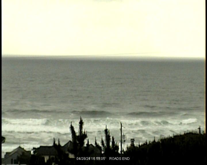
Live Cams (Roads End, Newport and Florence)
http://www.lcsurfshop.com/webcam.htm

http://cil-www.oce.orst.edu/yhead/latest.c0.snap.jpg
http://apps.lanecounty.org/WebCams/Home/Image?location=hv&index=1&width=1000&landscape=true
Satellite (Oregon North)

MM5 Forecast
Last Updated: 11:06 pm - 7/31/2026
Saturday
| Hour: | 0 | 1 | 2 | 3 | 4 | 5 | 6 | 7 | 8 | 9 | 10 | 11 | 12 | 13 | 14 | 15 | 16 | 17 | 18 | 19 | 20 | 21 | 22 | 23 |
|---|---|---|---|---|---|---|---|---|---|---|---|---|---|---|---|---|---|---|---|---|---|---|---|---|
| Manzanita | ||||||||||||||||||||||||
| Oceanside | ||||||||||||||||||||||||
| Roads End | ||||||||||||||||||||||||
| Newport | ||||||||||||||||||||||||
| Florence | ||||||||||||||||||||||||
| Port Orford | ||||||||||||||||||||||||
| Gold Beach |
Sunday
| Hour: | 0 | 1 | 2 | 3 | 4 | 5 | 6 | 7 | 8 | 9 | 10 | 11 | 12 | 13 | 14 | 15 | 16 | 17 | 18 | 19 | 20 | 21 | 22 | 23 |
|---|---|---|---|---|---|---|---|---|---|---|---|---|---|---|---|---|---|---|---|---|---|---|---|---|
| Manzanita | ||||||||||||||||||||||||
| Oceanside | ||||||||||||||||||||||||
| Roads End | ||||||||||||||||||||||||
| Newport | ||||||||||||||||||||||||
| Florence | ||||||||||||||||||||||||
| Port Orford | ||||||||||||||||||||||||
| Gold Beach |
Monday
| Hour: | 0 | 1 | 2 | 3 | 4 | 5 | 6 | 7 | 8 | 9 | 10 | 11 | 12 | 13 | 14 | 15 | 16 | 17 | 18 | 19 | 20 | 21 | 22 | 23 |
|---|---|---|---|---|---|---|---|---|---|---|---|---|---|---|---|---|---|---|---|---|---|---|---|---|
| Manzanita | ||||||||||||||||||||||||
| Oceanside | ||||||||||||||||||||||||
| Roads End | ||||||||||||||||||||||||
| Newport | ||||||||||||||||||||||||
| Florence | ||||||||||||||||||||||||
| Port Orford | ||||||||||||||||||||||||
| Gold Beach |
Tuesday
| Hour: | 0 | 1 | 2 | 3 | 4 | 5 | 6 | 7 | 8 | 9 | 10 | 11 | 12 | 13 | 14 | 15 | 16 | 17 | 18 | 19 | 20 | 21 | 22 | 23 |
|---|---|---|---|---|---|---|---|---|---|---|---|---|---|---|---|---|---|---|---|---|---|---|---|---|
| Manzanita | ||||||||||||||||||||||||
| Oceanside | ||||||||||||||||||||||||
| Roads End | ||||||||||||||||||||||||
| Newport | ||||||||||||||||||||||||
| Florence | ||||||||||||||||||||||||
| Port Orford | ||||||||||||||||||||||||
| Gold Beach |
Color Key to Wind Speed
| 0 | 5 | 10 | 15 | 20 | 25 | 30 | 35 | 40 | 45 | 50 | knots |
Last Updated: 11:06 pm - 7/31/2026
NWW3 Wave Model
| Wed | Wed | Thu | Fri | Sat | Sun | Mon | Tue | Wed | Thu | Fri | Sat | Sun | Mon | Tue | Wed | Thu | |||||||||||||||||||||||||||||||||
|---|---|---|---|---|---|---|---|---|---|---|---|---|---|---|---|---|---|---|---|---|---|---|---|---|---|---|---|---|---|---|---|---|---|---|---|---|---|---|---|---|---|---|---|---|---|---|---|---|---|
| 12 | 6 | 6 | 12 | 6 | 6 | 12 | 6 | 6 | 12 | 6 | 6 | 12 | 6 | 6 | 12 | 6 | 6 | 12 | 6 | 6 | 12 | 6 | 6 | 12 | 6 | 6 | 12 | 6 | 6 | 12 | 6 | 6 | 12 | 6 | 6 | 12 | 6 | 6 | 12 | 6 | 6 | 12 | 6 | 6 | 12 | 6 | 6 | 12 | |
| 4 | 4 | 4 | 3 | 4 | 4 | 5 | 5 | 6 | 6 | 5 | 7 | 6 | 6 | 7 | 6 | 6 | 7 | 7 | 7 | 7 | 6 | 6 | 5 | 5 | 5 | 6 | 6 | 6 | 5 | 5 | 5 | 5 | 6 | 5 | 6 | 6 | 6 | 5 | 5 | 5 | 6 | 5 | 5 | 6 | 6 | 5 | 7 | 6 | |
| 39 | 39 | 38 | 38 | 38 | 48 | 48 | 59 | 59 | 68 | 58 | 77 | 67 | 67 | 77 | 68 | 68 | 78 | 78 | 79 | 79 | 68 | 68 | 58 | 57 | 57 | 67 | 68 | 68 | 58 | 58 | 58 | 58 | 59 | 59 | 59 | 69 | 58 | 58 | 48 | 47 | 56 | 56 | 46 | 66 | 56 | 56 | 67 | 67 | |
| 215 | 215 | 214 | 214 | 214 | 114 | 114 | 114 | 45 | 113 | 113 | 113 | 113 | 114 | 114 | 113 | 213 | 213 | 213 | 116 | 216 | 115 | 115 | 115 | 215 | 214 | ||||||||||||||||||||||||
| 113 | 118 | 117 | 117 | 117 | 116 | 115 | 115 | 115 | 115 | 115 | 114 | 114 | |||||||||||||||||||||||||||||||||||||
| 117 | 117 | ||||||||||||||||||||||||||||||||||||||||||||||||
Last Updated: 11:05 pm - 7/31/2026 - NWW3 Bulletin
NWW3 Graphs: Swell Period - Swell Height
Oregon Regions
Washington Regions
Cams
Charts
![]()