South Oregon Coast
Home to the the windiest place on the Oregon Coast, this is where Cape Sebastian and Pistol river are located. Other areas: North Oregon Coast, Central Oregon Coast
Quick Links:
Web Cams Wind Model Wave Model
Wind Observations
Last Updated: 8:47 pm - 8/2/2026 Surf Report
Last Updated: 8:47 pm - 8/2/2026 Tides for Gold Beach
Last Updated: 11:05 am - 8/2/2026 - NOAA tides |
NWS Forecast...SMALL CRAFT ADVISORY IN EFFECT THROUGH TUESDAY EVENING... Tonight N wind 20 to 25 kt with gusts up to 35 kt. Seas 5 to 8 ft. Wave detail: N 7 ft at 7 seconds and NW 4 ft at 9 seconds. Monday N wind 20 to 25 kt with gusts up to 30 kt. Seas 5 to 7 ft. Wave detail: N 6 ft at 6 seconds and NW 4 ft at 9 seconds. Monday Night N wind 20 to 25 kt, easing to 15 to 20 kt after midnight. Seas 7 to 9 ft, subsiding to 5 to 8 ft after midnight. Wave detail: N 8 ft at 7 seconds and W 4 ft at 9 seconds. Patchy smoke after midnight. Tuesday N wind 10 to 15 kt, rising to 15 to 20 kt in the afternoon. Seas 5 to 7 ft. Wave detail: NW 5 ft at 8 seconds. Tuesday Night N wind 15 to 20 kt, easing to 10 to 15 kt after midnight. Seas 5 to 7 ft. Wave detail: NW 5 ft at 8 seconds. Wednesday N wind 5 to 10 kt. Seas 5 to 6 ft. Wave detail: NW 5 ft at 7 seconds. Wednesday Night N wind 5 to 10 kt. Seas 4 to 5 ft. Wave detail: NW 3 ft at 6 seconds and NW 5 ft at 9 seconds. Thursday N wind 5 to 10 kt. Seas around 5 ft. Wave detail: NW 5 ft at 9 seconds and NW 2 ft at 6 seconds. Thursday Night N wind 10 to 15 kt, easing to 5 to 10 kt after midnight. Seas 4 to 5 ft. Wave detail: N 3 ft at 5 seconds and NW 3 ft at 9 seconds. Friday N wind 10 to 15 kt, rising to 15 to 20 kt in the afternoon. Seas 4 to 5 ft. Wave detail: N 4 ft at 5 seconds and NW 3 ft at 9 seconds. Friday Night N wind 15 to 20 kt. Seas 4 to 5 ft. Last Updated: 8:05 pm - 8/2/2026 |
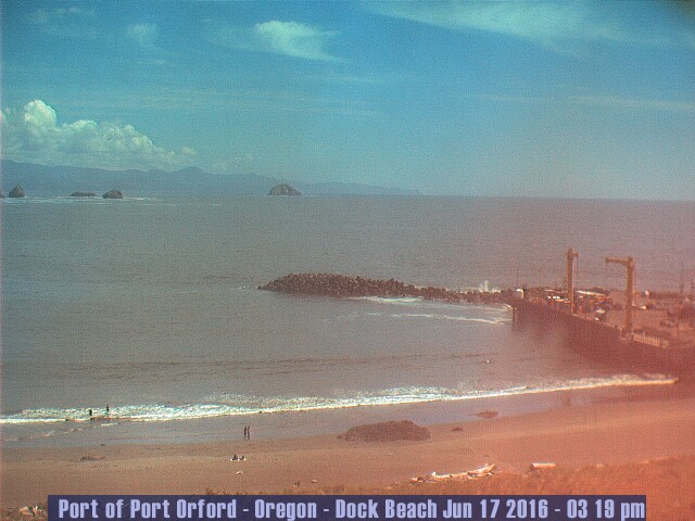
Live Cams (Bandon, Port Orford)

http://www.rwre.com/webcam/current_photo.jpg
http://www.gnifrus.com/netcam/netcam.jpg
Satellite (Oregon South)

MM5 Forecast
Last Updated: 11:06 am - 8/2/2026
Sunday
| Hour: | 0 | 1 | 2 | 3 | 4 | 5 | 6 | 7 | 8 | 9 | 10 | 11 | 12 | 13 | 14 | 15 | 16 | 17 | 18 | 19 | 20 | 21 | 22 | 23 |
|---|---|---|---|---|---|---|---|---|---|---|---|---|---|---|---|---|---|---|---|---|---|---|---|---|
| Manzanita | ||||||||||||||||||||||||
| Oceanside | ||||||||||||||||||||||||
| Roads End | ||||||||||||||||||||||||
| Newport | ||||||||||||||||||||||||
| Florence | ||||||||||||||||||||||||
| Port Orford | ||||||||||||||||||||||||
| Gold Beach |
Monday
| Hour: | 0 | 1 | 2 | 3 | 4 | 5 | 6 | 7 | 8 | 9 | 10 | 11 | 12 | 13 | 14 | 15 | 16 | 17 | 18 | 19 | 20 | 21 | 22 | 23 |
|---|---|---|---|---|---|---|---|---|---|---|---|---|---|---|---|---|---|---|---|---|---|---|---|---|
| Manzanita | ||||||||||||||||||||||||
| Oceanside | ||||||||||||||||||||||||
| Roads End | ||||||||||||||||||||||||
| Newport | ||||||||||||||||||||||||
| Florence | ||||||||||||||||||||||||
| Port Orford | ||||||||||||||||||||||||
| Gold Beach |
Tuesday
| Hour: | 0 | 1 | 2 | 3 | 4 | 5 | 6 | 7 | 8 | 9 | 10 | 11 | 12 | 13 | 14 | 15 | 16 | 17 | 18 | 19 | 20 | 21 | 22 | 23 |
|---|---|---|---|---|---|---|---|---|---|---|---|---|---|---|---|---|---|---|---|---|---|---|---|---|
| Manzanita | ||||||||||||||||||||||||
| Oceanside | ||||||||||||||||||||||||
| Roads End | ||||||||||||||||||||||||
| Newport | ||||||||||||||||||||||||
| Florence | ||||||||||||||||||||||||
| Port Orford | ||||||||||||||||||||||||
| Gold Beach |
Wednesday
| Hour: | 0 | 1 | 2 | 3 | 4 | 5 | 6 | 7 | 8 | 9 | 10 | 11 | 12 | 13 | 14 | 15 | 16 | 17 | 18 | 19 | 20 | 21 | 22 | 23 |
|---|---|---|---|---|---|---|---|---|---|---|---|---|---|---|---|---|---|---|---|---|---|---|---|---|
| Manzanita | ||||||||||||||||||||||||
| Oceanside | ||||||||||||||||||||||||
| Roads End | ||||||||||||||||||||||||
| Newport | ||||||||||||||||||||||||
| Florence | ||||||||||||||||||||||||
| Port Orford | ||||||||||||||||||||||||
| Gold Beach |
Color Key to Wind Speed
| 0 | 5 | 10 | 15 | 20 | 25 | 30 | 35 | 40 | 45 | 50 | knots |
Last Updated: 11:06 am - 8/2/2026
NWW3 Wave Model
| Sun | Mon | Tue | Wed | Thu | Fri | Sat | Sun | Mon | Tue | Wed | Thu | Fri | Sat | Sun | Mon | Tue | |||||||||||||||||||||||||||||||||
|---|---|---|---|---|---|---|---|---|---|---|---|---|---|---|---|---|---|---|---|---|---|---|---|---|---|---|---|---|---|---|---|---|---|---|---|---|---|---|---|---|---|---|---|---|---|---|---|---|---|
| 12 | 6 | 6 | 12 | 6 | 6 | 12 | 6 | 6 | 12 | 6 | 6 | 12 | 6 | 6 | 12 | 6 | 6 | 12 | 6 | 6 | 12 | 6 | 6 | 12 | 6 | 6 | 12 | 6 | 6 | 12 | 6 | 6 | 12 | 6 | 6 | 12 | 6 | 6 | 12 | 6 | 6 | 12 | 6 | 6 | 12 | 6 | 6 | 12 | |
| 6 | 6 | 9 | 10 | 9 | 9 | 8 | 9 | 8 | 8 | 7 | 6 | 6 | 6 | 5 | 5 | 5 | 6 | 8 | 8 | 9 | 9 | 9 | 8 | 8 | 7 | 7 | 7 | 7 | 7 | 7 | 7 | 6 | 5 | 5 | 6 | 5 | 7 | 7 | 7 | 7 | 6 | 6 | 6 | 7 | 7 | 7 | 7 | 7 | |
| 48 | 59 | 97 | 97 | 97 | 98 | 87 | 98 | 88 | 88 | 78 | 68 | 68 | 68 | 58 | 58 | 58 | 67 | 77 | 87 | 97 | 97 | 97 | 87 | 87 | 77 | 77 | 77 | 77 | 77 | 77 | 67 | 56 | 46 | 56 | 56 | 46 | 67 | 77 | 77 | 67 | 67 | 66 | 56 | 66 | 76 | 66 | 56 | 66 | |
| 113 | 113 | 113 | 114 | 114 | 113 | 113 | 113 | 113 | 112 | 112 | 111 | 117 | 116 | 115 | 115 | 114 | 114 | 114 | 115 | 115 | 114 | 114 | 117 | 18 | 115 | 37 | 215 | 214 | 118 | 218 | 217 | 216 | 216 | 215 | 215 | 29 | 39 | 39 | |||||||||||
| 114 | 114 | 112 | 112 | 112 | 113 | 118 | 117 | 114 | 116 | 116 | 215 | 215 | 115 | 115 | 114 | 216 | 216 | 216 | 215 | 215 | 215 | 214 | 214 | ||||||||||||||||||||||||||
| 113 | 18 | 116 | 18 | 116 | 19 | 119 | 114 | 114 | 110 | 115 | 114 | 114 | |||||||||||||||||||||||||||||||||||||
| 116 | 113 | 117 | 117 | 115 | |||||||||||||||||||||||||||||||||||||||||||||
Last Updated: 8:05 pm - 8/2/2026 - NWW3 Bulletin
NWW3 Graphs: Swell Period - Swell Height
Oregon Regions
Washington Regions
Cams
Charts
![]()